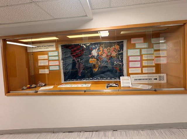
Students stitch a global map of fast fashion
Mapping Fast Fashion is an ongoing pedagogical project developed by Gisela Frias and Dawson’s Geography Department. As a means of exploring the present dominant economic model, the project engages students in critically examining fast fashion and the global web of economic, social, and environmental relations that sustain it. Through a series of course assignments, students actively participate in research, knowledge production, collective mapping, and knowledge sharing.
Research for this project began with students enrolled in the Geography of the World Economy course (Fall 2025). Working in groups, each student group focused on a specific node of the fast fashion commodity chain, from resource extraction to production, distribution, consumption, and disposal. This approach allowed students to identify key issues and compile geo-referenced data. Their research was used to produce concise summaries for each node of the commodity chain, and together the class authored a collective text that offers an overview of fast fashion today.
The project then took a material, embodied, and creative turn. A large textile world map was made using recycled clothing: the oceans are composed of blue jeans, while each continent is constructed from different fabrics. Students volunteered outside of class hours to design and hand-sew the map. The textile map was created collectively by students and teachers using fabric and second-hand clothing sourced from thrift stores. The making process was central to the learning experience; students gathered on the 8th floor to design, cut, stitch, assemble, and create the map. For many, this was their first experience sewing, underscoring the project’s emphasis on embodied, collaborative, and experiential learning. The collaboration of local textile artists Denise Olivares and Sarabeth Triviño was also crucial to the process.
Mapping Fast Fashion is an ongoing project. Students enrolled in the Winter 2026 semester are currently researching case studies and contributing additional geo-referenced information to the textile world map. In the next academic year, the project aims to move beyond critique by mapping alternatives to fast fashion, including practices of repair, reuse, local and collective production, and more socially and environmentally just ways of producing and consuming clothing.
We invite you to visit the Geography Department’s window display, located at the end of the 4D wing. Spend some time exploring the intricate and power laden connections that bring our clothing together and reflect on the often hidden environmental, health, economic and labour costs embedded in what we wear.
–Text and photo by Gisela Frias