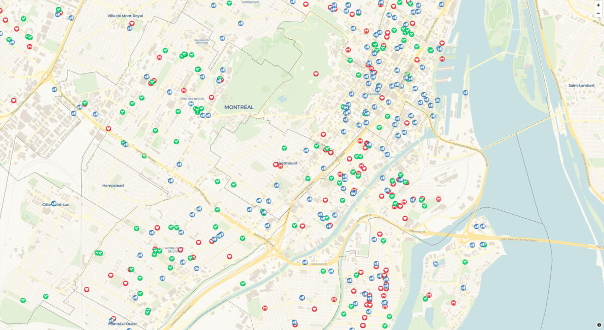
Food Map
A major contribution of Dawson’s Food Justice & Sustainability Hub is the construction of a database which includes approximately 14,000 food-related points across the entire Montreal food system. This database feeds directly into the Food Map of Montreal, which provides interactive information regarding food accessibility and availability for local communities and individuals. This map is delineated by neighbourhood for the entire island of Montreal.
The map consists of both community food assets such as gardens, fresh food drop-off points, and food bank services as well as conventional food system sites such as restaurants, grocery stores, and depanneurs. Community food assets are highlighted in the map, with a total number of assets for each borough and municipality in the first view of the map. Zoom in to see the commercial food locations. To identify community-based assets that would appear on the map, round tables with stakeholders were held to understand the needs of people on the ground who would benefit from such a map.
When selecting a point on the map, the user can see information about food resources. Various data such as telephone number, website, address and opening hours are listed. Users of the map able to see that some areas of the city have a higher concentration of food banks, urban agriculture projects, or food basket pick-up locations. You can also make suggestions for changes to the map—email us with edits and your ideas!